Garmin Bluechart mobile app now available!
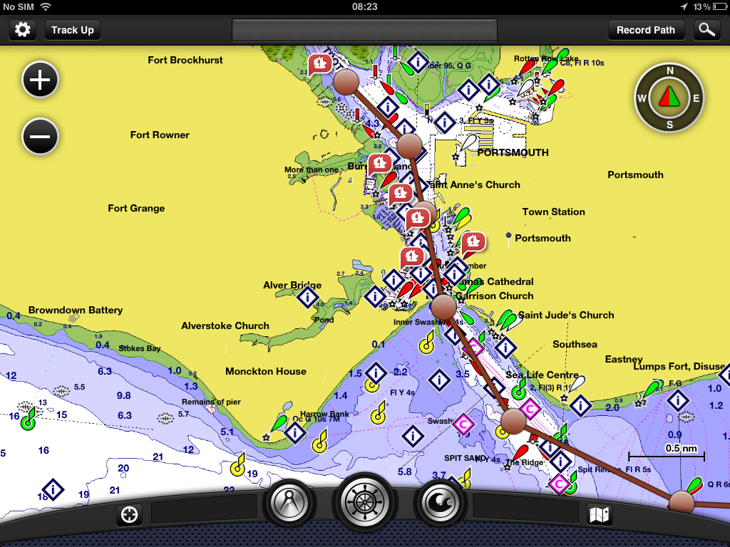
The Garmin
Bluechart mobile app which utilises the same BlueChart data available for
Garmin chartplotters is now available to download for your I-pod, I-phone and I-pad
on the Apple I-tunes store.
Users can
plan and create routes, view shaded depth contours and inter-tidal zones with
spot soundings and can search for a marine service point to find out the phone
number VHF channel, hours of operation, and information about amenities and
services available. Users will also have accurate weather tide and current data
available right at their fingertips.
Once on
board, users can wirelessly transfer routes, waypoints and tracks created with
BlueChart Mobile to a networked Garmin chartplotter. To wirelessly transfer
information, users need to have a router installed and connected to a
compatible Garmin chartplotter, or one of the new GPSMAP or Echomap’s when
available in 2013.
Once
underway, the iPad or iPhone can be used to “follow the boat” along its route
by wirelessly sharing the GPS location from the Garmin marine network. This
capability enables precise GPS positioning, even when you’re I-pad looses GPS
signal.

The app
itself is free to download; additional chart downloads will vary in price by
region. For more information about this and Garmin’s marine product offerings
visit garmin.co.uk/onthewater
for more information on Garmin’s mobile apps please click here.