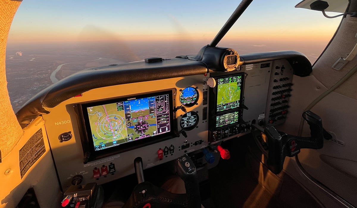
Garmin Pilot 6.2 Introduces Features for Android Devices
Garmin Pilot users with Android devices can now enjoy a host of new features with the latest software release – version 6.2. The features include charts overlays on the moving map, enhancements to stadium TFRs, glide range ring and logbook tracks. We’ve also added automatic downloads to ensure your data is always current, along with improved sorting of stored flight plans.
Chart Overlays
Pilots that use geo-referenced Garmin FliteCharts now have the option to overlay instrument approach procedures on the moving map. The chart overlays may be used for North Up or Track Up flying, providing a seamless transition from the enroute to approach phase of flight.
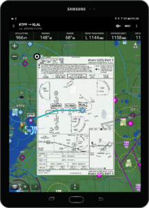
Chart Overlays.
To display instrument procedures on the moving map:
- From the radial menu, tap the airport followed by ‘Proc’ and select the procedure
- When viewing the chart from the binder, select ‘Show on Map’
- Select ‘Show on Map’ viewing the procedure from the Airport page
To remove the chart over overly, tap the settings wheel, located on the top left of the chart. You may also change the map layer order or opacity from the setting wheel.
Enhanced Stadium TFRs
Stadium TFRs have been enhanced to display the event, hosting venue and start time along with a color coding to represent the active state.
The schedules for Major League Baseball, the National Football League, NCAA Football, NASCAR Sprint Cup, Indy Car, and Formula 1 car racing are monitored, along with the associated stadium TFRs, and are displayed by the active state.
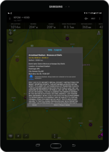
Enhanced stadium TFRs.
To view, select TFRs from the Overlay icon on the Map page
- Blue TFRs – event one to seven days in the future
- Yellow TFRs – event within the next 24 hours
- Red TFRs – active TFR, one hour before the scheduled start time
If you only wish to see active TFRs or those that will become active within 24 hours:
- Select General from the Map Layer icon on the Map page
- Turn Include Stadium TFRs to OFF
Glide Range Ring
A cyan ring can be displayed on the moving map to depict the estimated area that can be reached by the aircraft in the best glide range configuration. The glide range may be displayed as a ring or configured to show the impact of nearby terrain and wind data.
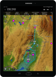
Glide Range Ring.
Glide Range is based on:
- Best Glide (VG) speed
- Glide ratio
- Winds aloft from ADS-B or data stored before flight
In order to use this feature, you need to configure the glide range speed and ratio for your aircraft under the ‘Settings’ page. To display the Glide Range, select ‘Ownship/Route’ from the map layer icon on the Map page.
Logbook Tracks
Automatically create a track of your flight and attach the file to the entry in your pilot logbook with this new feature. You may view a track on the map by:
- Selecting Show on Map from the logbook entry
- Adding the Logbook Tracks widget from split screen mode and choosing a track
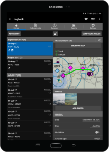
Logbook Track.
To remove a track from the map, select the Track icon from the radial menu and toggle off the track. (The radial menu is displayed by a single tap on the Map page.)
Tracks may be shared by selecting the share icon from the logbook entry.
Automatic Downloads
File updates and next cycles of your existing data and charts will be automatically downloaded to your device, as they become available. This may require additional storage space.
You may manage automatic downloads under the Downloads section in Settings.
Flight Plan Improvements
Based upon customer feedback, we have added the ability to sort stored flight plan. From the Map or Flight Plan page, tap the bookmark icon and then choose to order your flight plans alphabetically or by custom sort.
For more information about Garmin Pilot, contact us at [email protected]. Follow us on Facebook, Twitter and Instagram for all the latest Garmin Aviation announcements, news and stories.


