
Garmin Pilot: What’s New in Version 9.3
Just in time for the spring flying season we’ve introduced a host of new Garmin Pilot features for iOS devices. Version 9.3 adds airspace alerting, icing in the flight profile view, weather and traffic enhancements, mile markers for extended centerlines plus support for the iPhone X.
For our European users with Garmin Pilot Europe Premium, 9.3 adds an Aircraft Setup Guide to assist in properly configuring your aircraft for IFR auto-routing and flight plane filing.
Airspace Alerting
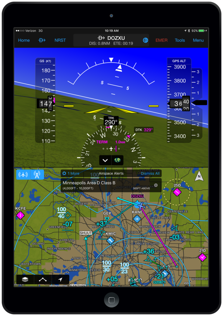
Garmin Pilot 9.3 adds airspace alerts to notify pilots prior to entering airspaces during flight.
By Selecting Airspace Alerts under the General tab in Settings, pilots may select the airspaces for which to receive alerts along with the horizontal and vertical distance parameters.
Airspace alerting may also be used for preflight planning by selecting Show Airspaces on FPL from the Menu on the Map page or in the Airspace Alerts section of General Settings.
Icing in the Flight Profile View
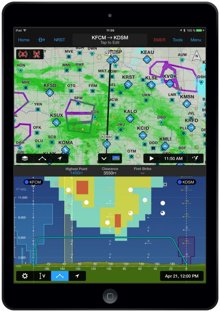
The Flight Profile view functionality has been expanded to display icing for your flight plan. Available for the U.S. and Canada, icing may be viewed by probability or severity plus supercooled liquid drops (SLD).
The Flight Profile view is available by selecting split screen from the Map page on iPad or the Home Screen Main Menu on iPhone. From the Settings wheel, choose Icing and select the type of data you wish to display.
Storm Cell Movement

The radar display has been enhanced to include the projected path of a storm cell. A circle and line extends from the storm cell to display the predicted path in 15, 30, 45 and 60 minutes. If hail or tornadic activity is present, the corresponding icon will appear. The radial menu will display additional information about the cell activity, including speed, direction and more.
To activate, tap the storm cell icon while your radar is animating. You may also touch the time stamp to step through the animation to view the data.
SiriusXM Surface Analysis
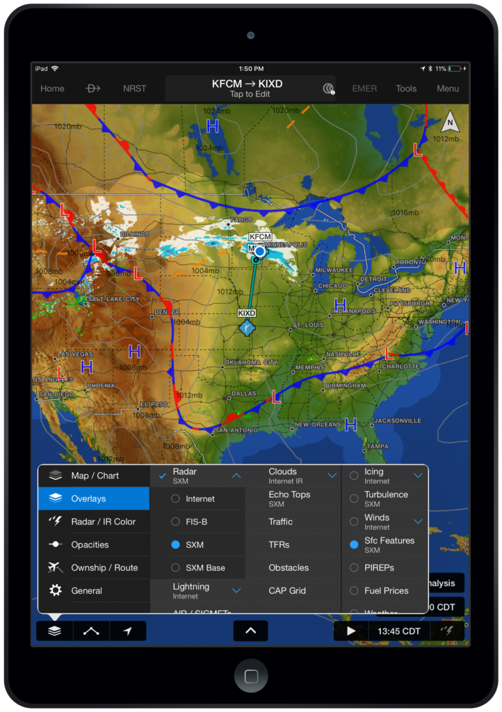
For users with a GDL 69, 51 or 52, along with a valid SiriusXM weather subscription, Garmin Pilot displays a surface analysis layer on the dynamic map. View isobars, pressure systems, fronts, troughs, ridges and more.
To display SiriusXM Surface Analysis:
- Connect to a SiriusXM device
- From the Map page, select Overlays from the map layer icon
- Choose Sfc Features overlay on the map
Traffic Enhancements
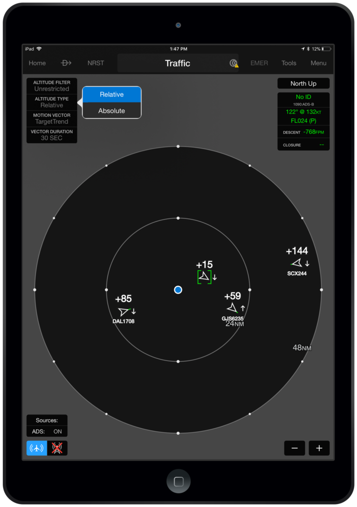
For users with Garmin ADS-B receivers, both the full screen and split screen traffic pages have been enhanced as follows:
- Pinch zoom gestures will change the range of the traffic displayed
- Traffic is displayed in Relative or Absolute Altitude
Extended Centerline Improvement
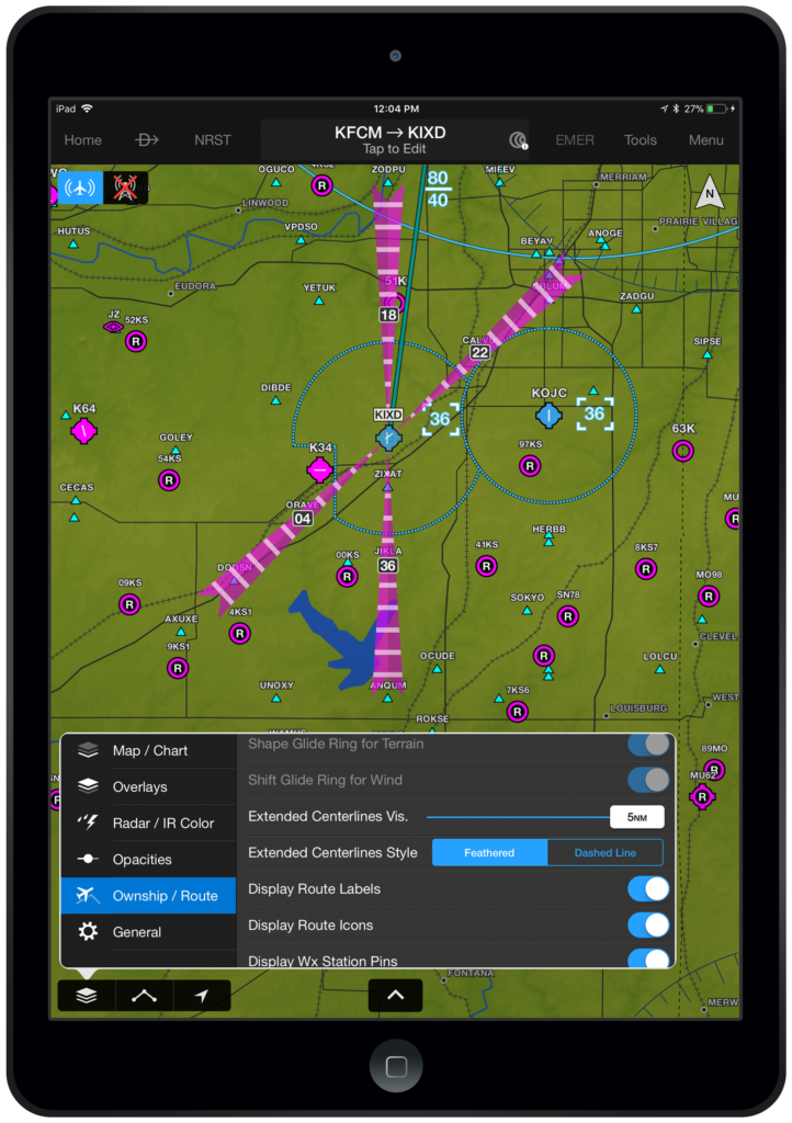
Extended runway centerlines have been improved to display the mile markers for airports in your current flight plan.
To display Runway Centerlines:
- From the Map page, select Ownship / Route from the map layer icon
- Choose the desired Extended Centerline Style (i.e. Feathered or Dashed Line)
- Select the visibility range
iPhone X Support
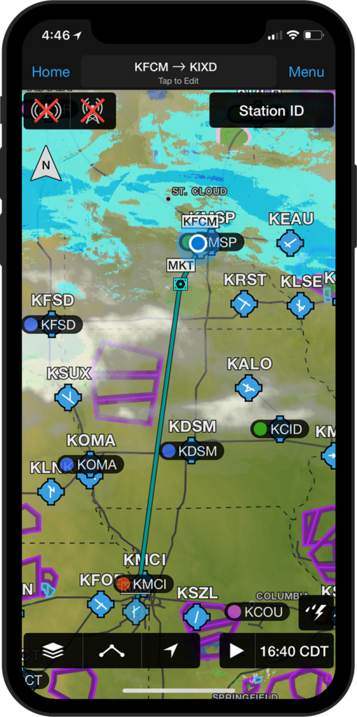
- Garmin Pilot has been optimized to support the high resolution, all-screen design of the Apple iPhone X.
Aircraft Setup Guide
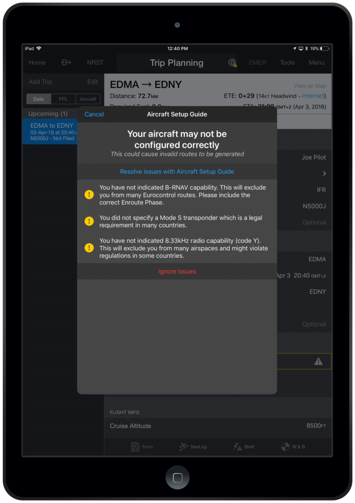
For users with a Garmin Pilot Europe Premium license, we have added an Aircraft Setup Guide. The guide will ensure you have the appropriate ICAO, mass & balance and performance settings for your aircraft in order to obtain an autorouting from EuroControl.
If your aircraft is not properly configured, a yellow rectangle and warning triangle will appear around the autoroute section in Trip Planning. Tap the triangle to view the alert and open the Aircraft Setup Guide to resolve configuration issues.
Aircraft Library
The Garmin Pilot aircraft library has been expanded to include new profiles for Cessna, Mooney, Piper. You may access the library from the Aircraft tab in Settings.
For more information on Garmin Pilot and our entire suite of aviation products, visit garmin.com/aviation.


