Garmin® adds new BlueChart g3 and LakeVü g3 with Navionics cartography to its popular ECHOMAP Plus series
OLATHE, Kan.–(BUSINESS WIRE)–Garmin International, Inc., a unit of Garmin Ltd. (NASDAQ:GRMN), today
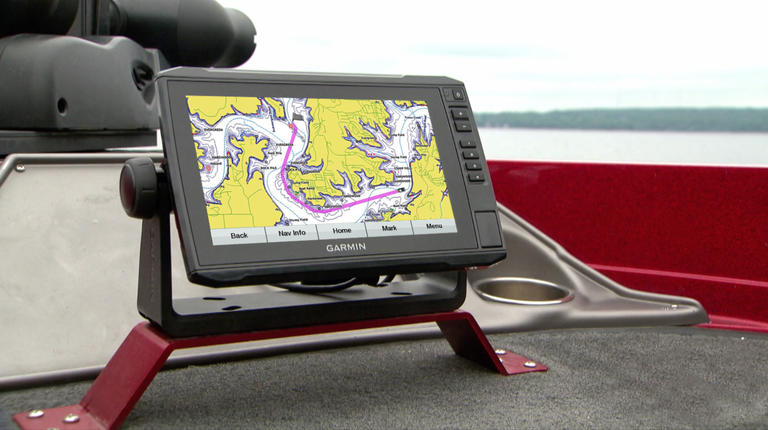
announced that its popular line of ECHOMAP™ Plus sonar combination units
will now include its new BlueChart
g3 and LakeVü
g3 cartography products built-in for coastal and inland boating and
fishing. The new g3 charts and maps blend the best of both Garmin and
Navionics content together for the first time to deliver unparalleled
coverage and detail. The Garmin ECHOMAP Plus series is available in a
range of display sizes, and sold both with and without transducers, to
accommodate nearly every angler and budget.
“The ECHOMAP Plus is one of our best-selling product lines and we’re
pleased to bring our new BlueChart g3 and LakeVü g3 cartography with
Navionics content built-in to this series for both new and existing
customers,” said Dan Bartel, Garmin worldwide vice president of consumer
sales. “Garmin’s g3 products combine the best content from both Garmin
and Navionics to provide the highest quality detail and coverage
available to mariners today.”
The new Garmin g3 cartography brings unrivaled detail and convenience to
users with navigational aids, spot soundings, depth contours, tides and
currents, artificial reefs and fish attractors, and detailed harbors and
marinas. It offers seamless chart presentation with up to 1-foot fishing
contours that provide a more accurate depiction of bottom structure for
improved fishing charts and enhanced detail in canals, marinas and port
plans. New customers will benefit from this data built-in to the ECHOMAP
Plus series. Existing ECHOMAP Plus customers can utilize Garmin’s New
Chart Guarantee to receive a free update to the new g3 cartography. If a
customer has already taken advantage of the free update via their New
Chart Guarantee, BlueChart g3 and LakeVü g3 accessory cards and
downloads are available to purchase. Learn more at garmin.com/maps.
For even more detailed data and Auto Guidance1 technology, BlueChart
g3 Vision and LakeVü
g3 Ultra accessory cards are also available. Auto Guidance instantly
searches through relevant charts to create a suggested route based upon
the user’s desired depth and overhead clearance. In addition, BlueChart
g3 Vision also offers high-resolution satellite imagery that provides
the user with a realistic view of their surroundings. Unique 3-D views,
including MarinerEye and FishEye, provide additional perspective both
above and below the water line, and crystal-clear aerial photography
shows exceptional detail of many ports, harbors and marinas, which is
especially useful when entering unfamiliar ports. For inland customers,
LakeVü g3 Ultra includes maps of more than 17,000 lakes with up to
1-foot contours. Of those, over 150 are Garmin Elite surveyed lakes with
high-resolution satellite imagery, multi-beam sonar views
shore-to-shore, side scan photos and photos of notable spots above the
water too. LakeVü g3 Ultra also includes high-resolution relief shading
that adds visual depth to the 2-D map making it easier to interpret
contours, Dynamic Lake Level that allows the user to adjust their maps
at the lake’s current water levels, and more.
For crystal-clear scanning of fish and structure, the ECHOMAP Plus
series offers built-in CHIRP traditional sonar and CHIRP ClearVü™ and
SideVü scanning sonar capabilities, and the bundled versions now include
a Garmin GT transducer with a dedicated down element for increased
ClearVü depth performance of 500 feet. Instead of just sending one
single frequency, CHIRP sends a continuous sweep of frequencies and
interprets them individually upon their return, creating crisper fish
arches with better target separation. For anglers who want to see
objects and structure below the boat, ClearVü provides a nearly
photographic view with excellent resolution and target separation in
both freshwater and saltwater. The ECHOMAP Plus “sv” models also add
SideVü scanning for customers who want to see what’s located on both
sides of the boat. All 7- and 9-inch Plus units provide support for all
Garmin Panoptix™ all-seeing sonar transducers, including Panoptix
LiveScope™, so anglers can see real-time sonar imagery at video-like
speed.
The updated ECHOMAP Plus series will be available starting Jan. 11,
2019, with suggested retail prices ranging from $199.99 to $1099.99. For
more information, visit garmin.com/marine.
Garmin is the world’s leading marine electronics manufacturer2
and was recently named Manufacturer of the Year for the fourth
consecutive year by the NMEA, an honor given to the most recognized
marine electronics company for support of products in the field.
Garmin’s portfolio includes some of the industry’s most sophisticated
chartplotters and touchscreen multifunction displays, sonar technology,
high-definition radar, autopilots, high-resolution mapping, sailing
instrumentation, audio, entertainment and other products and services
that are known for innovation, reliability, and ease-of-use. Other
Garmin marine brands include FUSION Entertainment, Navionics, a premier
supplier of electronic navigation charts, and EmpirBus.
For decades, Garmin has pioneered new GPS navigation and wireless
devices and applications that are designed for people who live an active
lifestyle. Garmin serves five primary markets, including automotive,
aviation, fitness, marine, and outdoor recreation. For more information,
visit Garmin’s virtual pressroom at garmin.com/newsroom,
contact the Media Relations department at 913-397-8200, or follow us at facebook.com/garmin,
twitter.com/garmin,
instagram.com/garmin
or youtube.com/garmin.
1 Auto Guidance is for planning purposes only and does not
replace safe navigation operations.
2 Based on 2017
reported sales.
About Garmin International Inc. Garmin International Inc. is a
subsidiary of Garmin Ltd. (Nasdaq: GRMN). Garmin Ltd. is incorporated in
Switzerland, and its principal subsidiaries are located in the United
States, Taiwan and the United Kingdom. Garmin and BlueChart are
registered trademarks and ECHOMAP, ClearVü, Panoptix and LiveScope are
trademarks of Garmin Ltd. or its subsidiaries.
All other brands, product names, company names, trademarks and service
marks are the properties of their respective owners. All rights reserved.
Notice on Forward-Looking Statements:
This release includes forward-looking statements regarding Garmin Ltd.
and its business. Such statements are based on management’s current
expectations. The forward-looking events and circumstances discussed in
this release may not occur and actual results could differ materially as
a result of known and unknown risk factors and uncertainties affecting
Garmin, including, but not limited to, the risk factors listed in the
Annual Report on Form 10-K for the year ended December 30, 2017, filed
by Garmin with the Securities and Exchange Commission (Commission file
number 0-31983). A copy of such Form 10-K is available at http://www.garmin.com/aboutGarmin/invRelations/finReports.html.
No forward-looking statement can be guaranteed. Forward-looking
statements speak only as of the date on which they are made and Garmin
undertakes no obligation to publicly update or revise any
forward-looking statement, whether as a result of new information,
future events, or otherwise.
![]()
Contacts
-
Images
